How does La Niña form and how does it affect snowfall in Arizona?
Winter is coming and new forecast shows La Niña probably is too
PHOENIX (AZFamily) — The NOAA’s Climate Prediction Center’s new update says La Niña is likely on the way later this fall or winter. La Niña can impact weather patterns here in Arizona, especially during the winter.
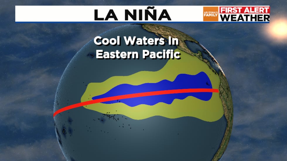
Before we get into winter impacts, let’s first discuss how La Niña forms. The explanation starts with trade winds which typically blow along the equator from east to west. During La Niña, these wind can be stronger than normal.
This pushes warmer Pacific Ocean water towards the west. In the eastern Pacific, the departure of the warmer water allows cooler water deeper in the ocean to rise to the surface. This, in turn, causes cooler-than-normal waters in the eastern Pacific ocean near the equator.
The cooler area of water in the Pacific can influence the weather pattern. During the winter, La Niña tends to bring wet weather to parts of the northern U.S. and drier weather to parts of the southern U.S.
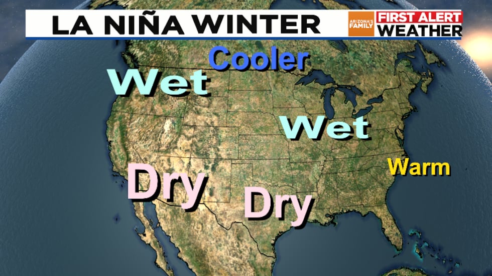
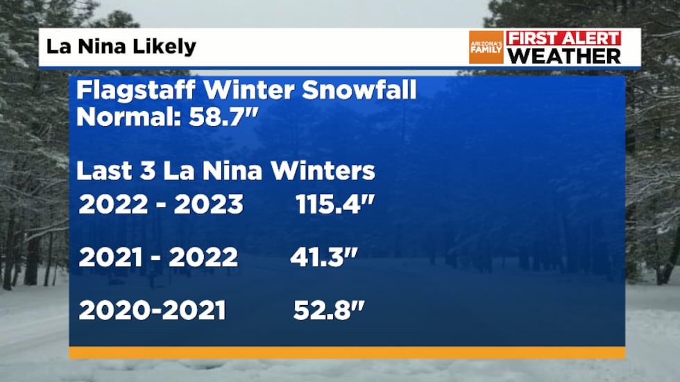
In Arizona, La Niña often coincides with below normal precipitation for areas like Phoenix and Flagstaff. But this is not always the case. Notice that in the past three La Niña winter episodes, Flagstaff received below normal snowfall in two out of three cases.
See a spelling or grammatical error in our story? Please click here to report it.
Do you have a photo or video of a breaking news story? Send it to us here with a brief description.
Copyright 2024 KTVK/KPHO. All rights reserved.


