How the Horseshoe 2 wildfire devastated parts of southern Arizona 14 years ago
PHOENIX (AZFamily) — It’s been 14 years since May 8, 2011, when the Horseshoe 2 wildfire broke out in southeast Arizona, and became one of the largest wildfires in the state’s history.
The National Weather Service notes that “by the time it was contained in June, it had consumed over 222,000 acres and was Arizona’s fifth largest wildfire.”
A study from NASA suggests that human activities are likely the cause of the fire’s start.

The fire started in the southeastern part of the Chiricahua Mountains. Dry conditions and gusty winds helped fan the flames, leading to a rapidly growing fire.
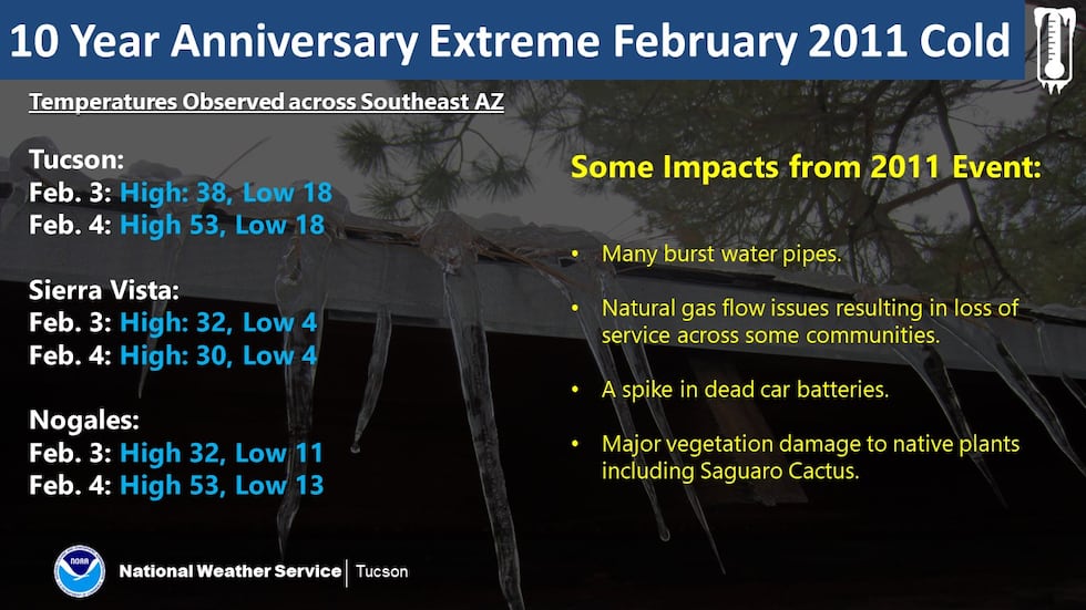
Making the dry environment worse was a record freeze over the previous winter that “damaged or killed many oaks and pines, further drying them,” according to the Chiricahua Regional Council.
Indeed, much of southeast Arizona experienced a record freeze in February 2011. The NWS Tucson office posted the data below on Facebook several years ago.
During the Horseshoe 2 Fire, the council noted that 23 structures were destroyed, but most of them were outbuildings like sheds and garages. The firefighters’ efforts during extremely challenging conditions are credited with saving many homes and other structures.
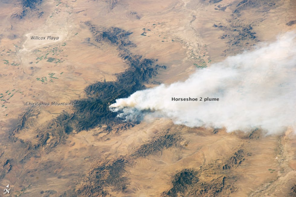
This image from NASA was taken by an astronaut from space on May 15, 2011. Notice the huge plume of smoke being pushed east of the Chiricahua Mountains.
A few weeks after the Horseshoe 2 Fire, the Wallow Fire began in the White Mountains. The Wallow Fire is the largest wildfire in Arizona’s history. You can read more about the Wallow Fire and other significant Arizona fires.
See a spelling or grammatical error in our story? Please click here to report it.
Do you have a photo or video of a breaking news story? Send it to us here with a brief description.
Copyright 2025 KTVK/KPHO. All rights reserved.